"沿着蜿蜒的米仓古路,探寻地球和人类历史的痕迹"
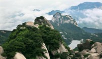
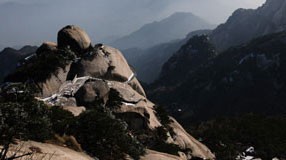
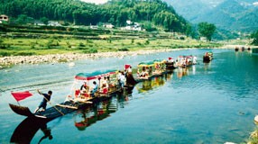
位于巴中市北部的米仓山地区,分别由光雾山园区与诺水河园区两部分构成,面积1818 平方千米 。北临陕西汉中,南频四川盆地,东为大巴山主脉,西接龙门山,跨四川省巴中市南江县,通江县,行政区划建属干巴中市,公园内最且雪撼力的景观是岩浴地貌景观,包括地表和地下岩浴地貌,是中国南北岩溶过渡地区岩浴地貌的典型代表,是研究中国岩浴的理想场所和关键地区。
地质公园的地学内涵极为深广,主要体现在完整典型的扬子地块及其盖层地层剖面、喀斯特地貌景观、古生物化石景观等方面,具有重要的科学价值,对于解析特提斯外围盆地,秦岭(中央)造山带以及四川盆地地质演化历史,乃至整个扬子地块的演化发展具有重要的科学意义。
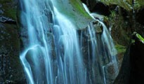
(1)公园位于中国南北喀斯特地貌分界线上,发育以诺水河洞穴群及奇绝美伦的钙华(亿万鹅管、雄川瀑布、石盾群等)、空山天盆坡立谷、燕子岭和贾郭山岭脊型峰丛、临江丽峡等为代表的喀斯特系列景观,兼有南方管道-暗河式喀斯特和北方千谷-溶隙型喀斯特景观的特征,是中国南北喀斯特界线上的一颗璀璨明珠。
(2)公园位于我国东西向的昆仑-秦岭-大别山中央造山带与纵贯中国腹部南北向的贺兰山-六盘山-龙门山-康滇地轴巨型造成山带近直交的十字形构造带中心,属米仓山造山带。是研究扬子地块北缘与秦岭造山带、龙门山造山带之间的构造转换关系,以及大陆动力学最典型的区域。
(3)公园系统完整展示了由扬子地块北缘古老变质岩系组成的古地块与震旦系—中三叠统海相沉积,以上三叠统-新近系的陆相沉积地层剖面。它是中国乃至世界上研究古大陆形成演化、中新生代陆内造山带的天然地质博物馆。
(4)公园是“蜀兽目”动物的发现地和命名地。公园内古生物化石较为丰富。特别珍贵的是中侏罗统沙溪庙组产董氏蜀兽Shuotheriumdongi,三列齿兽科Tritylodontidae,“董氏蜀兽”距今约1.5亿年,是世界上最古老的哺乳动物化石之一,由中科院周明镇院士命名,并以此建立了“蜀兽目”,该化石的发现,对生物演化序列的研究具有重要意义。
Celebrating Earth Heritage
Guangwushan-Nuoshuihe UNESCO Global Geopark is located in Bazhong, Sichuan Province of southwest China. This region has a subtropical monsoon climate. The Geopark’s topography consists of moderate to deep cut mountains with higher altitudes in the north and lower altitudes in the south. Guangwushan, the main peak of Micang Mountain, with a height of 2,507 meters, is the highest point of the Geopark.
The region is located at the junction area of the southern central Orogenic Belt (the Qinling) and Yangtze Block. The natural landscape of the area reveals a sedimentary sequence of the northern Yangtze tectonic plate, karst landforms, waterfalls and ponds as well as tectonic landforms. It is an important place for analysing the geological evolution of the peripheral basins of the Tethys, Central Orogenic Belt, Daba Mountains Orogenic Belt and Sichuan Basin, and the Yangtze Block. The area is of great scientific importance about research on continental dynamics, processes of mountain building and the structural relationship between the northern Yangtze tectonic plate and the orogenic belts of the Longmen and Daba mountain ranges. It marks the transition zone between southern and northern karst landforms with karst formation both on and below the surface. Important paleontological fossils were found in this region such as Shuotheriumdongi, one of the oldest mammal fossils, which was discovered in 1982 at Ganchang Town, and later named by academician Zhou Mingzhen of the Chinese Academy of Sciences.
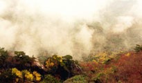
Guangwushan-Nuoshuihe UNESCO Global Geopark is one of the largest protection zones worldwide for Fagus pashanica, a living plant fossil from the glacial period. The area is also known as the hometown of red leaves in China.
Sustaining local Communities
The Guangwushan-Nuoshuihe UNESCO Global Geopark comprises 17 villages and towns with about 120,000 residents.
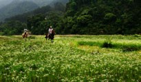
Since the Qin Dynasty and the Han Dynasty, the Ancient Micang Road winds itself through the landscape between Shaanxi and Sichuan connecting the civilizations of the ancient Yellow River and Bashu. Traces of many cultures and different dynasties can be found along this ancient road. Historical relics of local significance include the Drum Beating Village Ruins of Neolithic Age, the cities of Guancangping and Muyang of the Qin and Han Dynasties, Bazhong Grotto and Pingliang City of the Tang and Song Dynasties as well as the Baiyi and the Enyang Ancient Town. These relics provide unique insights into the historical and cultural development of China. The Ba-ethnic culture of the region is characterized by local folk traditions such as traditional wedding drums, Bazhong Shadow Puppet show, Maoshan Folk Songs, the Bashan Beier Song or the Fanshan Jiaozi Dance, national intangible cultural heritage of China.
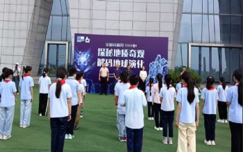
Guangwushan-Nuoshuihe UNESCO Global Geopark has a high scientific value with a great amount of research being carried out in the region. Science popularization and the protection of geoheritage is of particular importance. Since the establishment of the Geopark, many human and material resources have been invested in protection initiatives; protection zones and tourist passages have been established, along with explanation boards, fences and other conservation measures, particularly targeted at geoheritage sites, landscape and the ecological environment.


